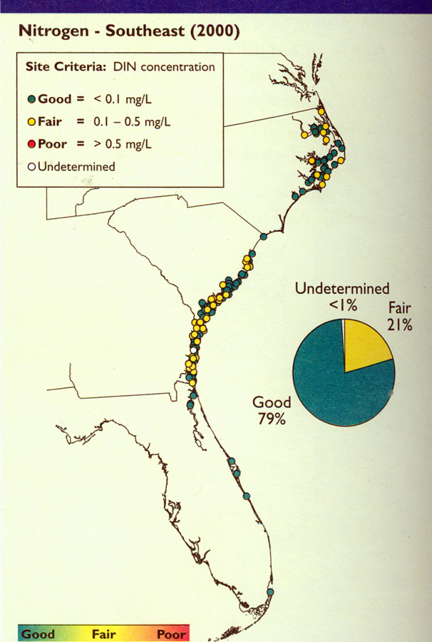
Description: Map shows DIN concentration data for Southeast Coast estuaries in 2000 C.E. Levels of nitrogen range from good to poor, with good being less than 0.1 mg/L DIN concentration and poor being more than 0.5 mg/L DIN concentration.
Place Names: 2000-,
ISO Topic Categories: economy, oceans, environment
Keywords: Nitrogen in Southeast, physical, political, statistical, hydrological, economy, oceans, environment, Unknown,2000
Source: , National Coastal Condition Report II (Washington, DC: Environmental Protection Agency, 2004) 114
Map Credit: Courtesy the private collection of Roy Winkelman |
|