Puzzle Directions: Click on a puzzle piece and drag it where you want it. When you connect two pieces correctly, they will join together. Mix up the pieces again. View finished map in pop-up window. |
|
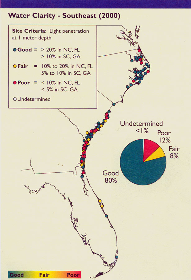
Title: Water Clarity in Southeast
Projection: Unknown
Source Bounding Coordinates:
W: E: N: S: |
| | Description: Map shows water clarity in the Southeast United States during the year 2000 C.E. Levels of clarity range from good to poor. With some states percentages differing from others due to water conditions and locations.
Source: , National Coastal Condition Report II (Washington, DC: Environmental Protection Agency, 2004) 116
Map Credit: Courtesy the private collection of Roy Winkelman |
| |
|