mapsExploring Florida
 FL Maps > Region > 1840-1859 > A General Reconnoissance of the Western Coast of Florida, 1851
Site Map 

A General Reconnoissance of the Western Coast of Florida, 1851


Puzzle Directions: Click on a puzzle piece and drag it where you want it. When you connect two pieces correctly, they will join together. Mix up the pieces again. View finished map in pop-up window.

Title: A General Reconnoissance of the Western Coast of Florida
Projection: Unknown
Source Bounding Coordinates:
W: -84.5 E: -79 N: 30.5 S: 24

Back to Map Page
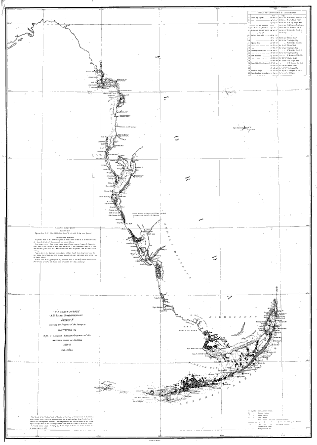
Description: Chart showing the west coast of Florida and the Keys with sailing directions including bearings, soundings, and a table of latitudes and longitudes. The map also shows the Mosquito Inlet and Cape Canaveral along the Atlantic Coast. Detailed triangulations are shown for the Florida Keys. A Native American District is shown just to the east of Charlotte Harbor as well as Indian hunting grounds at the southern tip of the Everglades. Surveyed by F. H. Gerdes. The mapscale is 1:1,200,000.
Source: F.H. Gerdes, U.S. Coast Survey (Washington, DC: Government Printing Office, 1851)
Map Credit: Courtesy the private collection of Roy Winkelman
SearchLicensePDF HelpGIS Help Google Earth Help Zoomify Help

 FL Maps > Region > 1840-1859 > A General Reconnoissance of the Western Coast of Florida, 1851