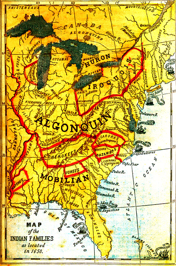
Description: A map of the Native American families and groups in North America east of the Mississippi River as located in 1650. The map shows Florida to be in the Mobilian family, with the Seminole group predominately in peninsular Florida and the Muscogee or Creek group in the panhandle region of the state. Also shown is the city of Saint Augustine and ships bearing the names of their associated explorers, De Leon near the Saint Johns River and De Soto near Tampa Bay.
Source: G. P. Quackenbos, Illustrated School History of the United States (New York, NY: D. Appleton and Company, 1875) 10
Map Credit: Courtesy the private collection of Roy Winkelman |
|