mapsExploring Florida
 FL Maps > Native Americans > Distribution of the Barbarous Tribes East of the Mississippi, 1491
Site Map 

Distribution of the Barbarous Tribes East of the Mississippi, 1491


Puzzle Directions: Click on a puzzle piece and drag it where you want it. When you connect two pieces correctly, they will join together. Mix up the pieces again. View finished map in pop-up window.

Title: Distribution of the Barbarous Tribes East of the Mississippi
Projection: Unknown
Source Bounding Coordinates:
W: E: N: S:

Back to Map Page
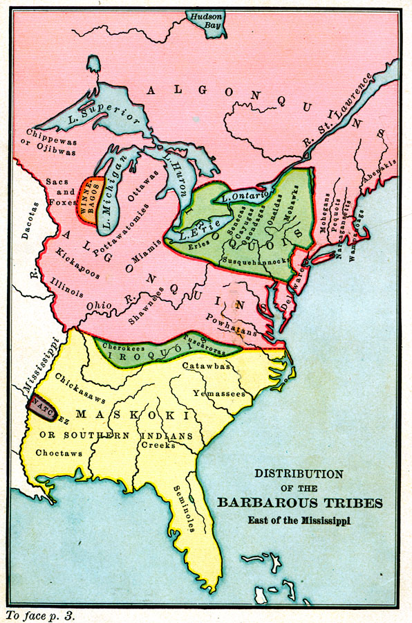
Description: A map of the Native American families and groups in North America east of the Mississippi River circa 1491. The map shows Florida to be in the Maskoki or Southern Indian family, with the Seminole group predominately in peninsular Florida and the Creek and Choctaw groups in the panhandle region of the state.
Source: Charles K. Adams and William P. Trent, A History of the United States (Boston, MA: Allyn and Bacon, 1909) 2
Map Credit: Courtesy the private collection of Roy Winkelman
SearchLicensePDF HelpGIS Help Google Earth Help Zoomify Help

 FL Maps > Native Americans > Distribution of the Barbarous Tribes East of the Mississippi, 1491