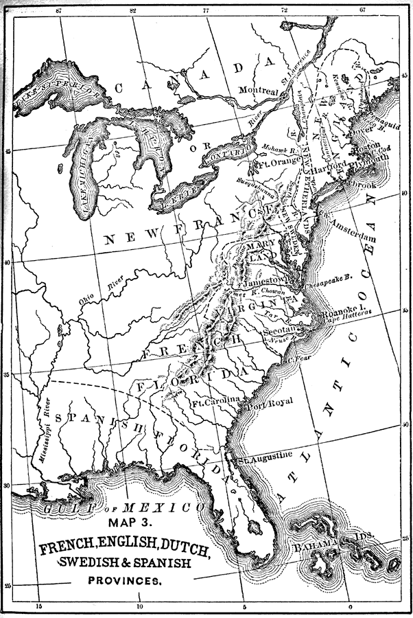
Title: French, English, Dutch, Swedish and Spanish Provinces
Projection: Unknown
Source Bounding Coordinates:
W: -90 E: -67 N: 50 S: 24 |
| | Description: A map of eastern North America showing the provinces claimed by various European countries. Spanish Florida is shown stretching from the mouth of the Saint Mary River westward to the Mississippi River to a point north of the Arkansas River near present day Memphis. To the north of Spanish Florida is and area labeled as French Florida on the map.
Source: Thomas Wentworth Higginson, Young Folks History of the United States (Boston, MA: Lee and Shepard, 1885) 64
Map Credit: Courtesy the private collection of Roy Winkelman |
| |
|