Puzzle Directions: Click on a puzzle piece and drag it where you want it. When you connect two pieces correctly, they will join together. Mix up the pieces again. View finished map in pop-up window. |
|
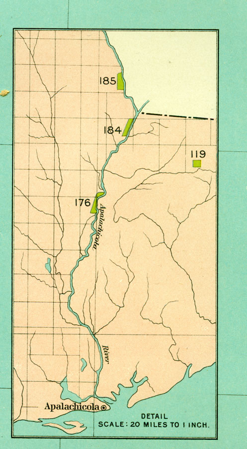
Title: Apalachicola Reservations
Projection: Unknown
Source Bounding Coordinates:
W: -88 E: -79 N: 31.25 S: 24.5 |
| | Description: A map of four Native American reservations located in the Florida panhandle along or near the Apalachicola River. These reservations are circa 1824 to 1832. The map also shows the Township/Range grid originating on the Tallahassee Base Line and Tallahassee Meridian. Map scale is 20 miles to 1 inch.
Source: Charles C. Royce, Bureau of American Ethnology: 18th Annual Report (Washington, DC: Government Printing Office, 1897)
Map Credit: Courtesy the private collection of Roy Winkelman |
| |
|