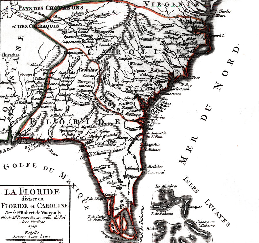
Title: La Floride, divisee en Floride et Caroline
Projection: Unknown
Source Bounding Coordinates:
W: 289 E: 306 N: 38 S: 25 |
| | Description: Digitization provided by the USF Libraries Digitization Center. Rare Maps Collection: G3865 1749 R63 Notes from USF Library: Relief shown pictorially. This is a map of Florida and the southeastern United States to the Carolinas. It shows inland waters, boundaries and names of states. It also shows the locations of some Native American tribes. Scale [ca. 1:8,200,000]; (E 2890--E 3060/N 380--N 250) Measurements.Dimensions: 16 x 17 cm., on sheet 19 x 25 cm.
Source: Gilles Robert de Vaugondy, (Paris, : , 1749)
Map Credit: Courtesy of the Special Collections Department, University of South Florida. |
| |
|