mapsExploring Florida
 FL Maps > State > 1860-1879 > Georgia & Florida, 1873
Site Map 

Georgia & Florida, 1873


Puzzle Directions: Click on a puzzle piece and drag it where you want it. When you connect two pieces correctly, they will join together. Mix up the pieces again. View finished map in pop-up window.

Title: Georgia & Florida
Projection: Unknown
Source Bounding Coordinates:
W: -87 E: -79.5 N: 35.5 S: 26

Back to Map Page
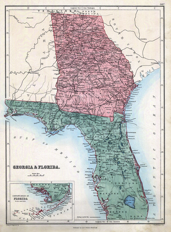
Description: Digitization provided by the USF Libraries Digitization Center. Rare Maps Collection: G3920 1873 .B37Notes from USF Library:Prime meridians: Washington, D.C. and Greenwich. Hand colored. Inset: Continuation of Florida. Same scale. "43C."Scale [ca. 1:2,914,560].; (W 10050Õ00Ó--W 3010Õ00Ó/N 35020Õ00Ó--N 26000Õ00Ó)Measurements.Dimensions: 45 x 33 cm.
Source: John Bartholomew, (Edinburgh, : A. & C. Black, 1873)
Map Credit: Courtesy of the Special Collections Department, University of South Florida.
SearchLicensePDF HelpGIS Help Google Earth Help Zoomify Help

 FL Maps > State > 1860-1879 > Georgia & Florida, 1873