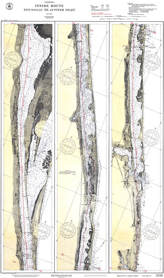
Description: A US Coast and Geodetic Survey map of the inland waterway between Titusville and the Jupiter Inlet. This survey chart shows all soundings expressed in feet. Navigational aids such as lights, beacons, buoys, and measures of magnetic declination variances are shown as well as obstructions such as bridges and submerged wrecks. The map scale is 1:80,000. Key to NOAA maps.
Place Names: 1920-1949, Fort Pierce, Vero, Melbourne, Cocoa, Titusville
ISO Topic Categories: transportation, oceans, inlandWaters
Keywords: Inland Water Route from Titusville to Jupiter Inlet, physical, transportation, hydrological, physical features, roads, water routes, water depths, transportation, oceans, inlandWaters, Unknown,1928
Source: US Coast and Geodetic Survey, (Washington, DC: US Coast and Geodetic Survey, 1928)
Map Credit: Courtesy the U.S. National Oceanic and Atmospheric Administration |
|