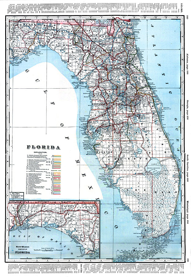
Description: Digitization provided by the USF Libraries Digitization Center. Rare Maps. This is a detailed map of Florida showing counties, railroads, cities, inland waters, etc. Includes grid. Insets: North-western portion of Florida -- Dry Tortugas. Measurements.Dimensions: 56 x 40 cm.Measurements.Resolution: Scale [1:1,267,200]
Source: Wm. M. Bradley and Bros., Bradley's atlas of the world for commercial and library reference (Philadelphia, PA: Wm. M. Bradley and Bros., 1889) 240-241
Map Credit: Courtesy of the Special Collections Department, University of South Florida. |
|