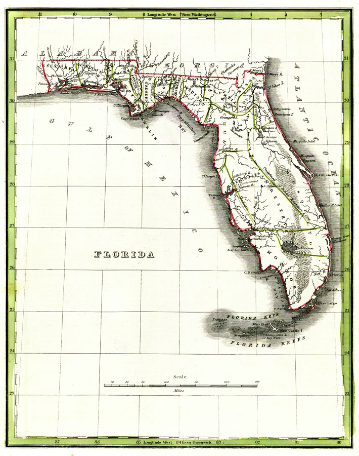
Description: Digitization provided by the USF Libraries Digitization Center. Rare Maps. This is a map of Florida showing counties, cities, inland waters, etc. Prime meridians: Greenwich and Washington. Measurements.Dimensions: 70 x 52 cm Measurements.Resolution: Scale (1:2,409,000)
Place Names: 1820-1839, Pensacola, Saint Augustine, Jacksonville, Tampa Bay, Seminoles, Cape Canaveral, Key West, Atlantic Ocean, Gulf of Mexico
ISO Topic Categories: inlandWaters, oceans, boundaries
Keywords: Florida, historical, physical, political, country borders, county borders, inlandWaters, oceans, boundaries, Unknown,1830
Source: Joseph Meyer, Rand McNally and Co.'s new business map of Florida (and) Rand McNally and Co.'s indexed atlas of the world (Philadelphia, PA: Rand McNally and Co., 1830)
Map Credit: Courtesy of the Special Collections Department, University of South Florida. |
|