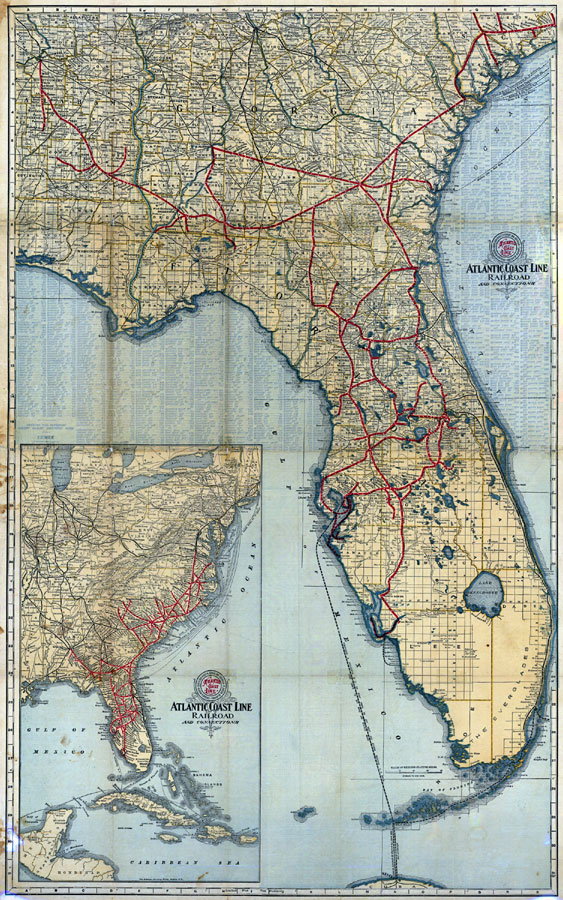
Description: Digitization provided by the USF Libraries Digitization Center. Rare Maps. This is a map of the state of Florida showing the semi-tropical resorts reached by the lines of Atlantic Coast Line circa 1905. It also shows counties, cities and towns, railroads and inland waters. Section Township Range (STR) is shown. There is also an inset map showing the east coast of the U. S. Publisher after the ACL acquisition of the Plant system in 1902, but before the creation of St. Lucie County in 1905. Measurements.Dimensions: 80 x 50 cm. , folded to 21 x 11 cm. Measurements.Resolution: Scale [ca.1:1,267,200].
Source: Atlantic Coast Line Railroad Company. Passenger Department, (Wilmington, Delaware: Atlantic Coast Line Railroad Company, 1905)
Map Credit: Courtesy of the Special Collections Department, University of South Florida. |
|