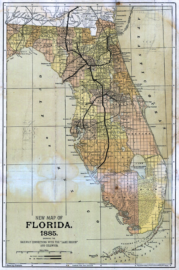
Description: Digitization provided by the USF Libraries Digitization Center. Rare Maps. This is a map of Florida showing showing the railway connections with the Lake region and Zellwood, circa 1860. It also shows counties, cities and towns and inland waters. Section Township Range (STR) is shown. Measurements.Dimensions: 44 x 29 cm. Measurements.Resolution: Scale [ca. 1:1,800,000].
Source: , (Philadelphia, PA: Jacob Weiss, 1860)
Map Credit: Courtesy of the Special Collections Department, University of South Florida. |
|