mapsExploring Florida
 FL Maps > State > 1880-1899 > Map of Florida, 1883
Site Map 

Map of Florida, 1883


Puzzle Directions: Click on a puzzle piece and drag it where you want it. When you connect two pieces correctly, they will join together. Mix up the pieces again. View finished map in pop-up window.

Title: Map of Florida
Projection: Unknown
Source Bounding Coordinates:
W: E: N: S:

Back to Map Page
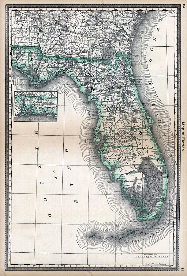
Description: Digitization provided by the USF Libraries Digitization Center. Rare Maps. This is a hand colored map of Florida showing counties, cities and towns, railroads and inland waters circa 1883. Measurements.Dimensions: 37.5 x 53 cm. Measurements.Resolution: scale [ca. 1:633,500]
Source: Rand McNally and Co., (Chicago, IL: Rand McNally and Co., 1883) 85
Map Credit: Courtesy of the Special Collections Department, University of South Florida.
SearchLicensePDF HelpGIS Help Google Earth Help Zoomify Help

 FL Maps > State > 1880-1899 > Map of Florida, 1883