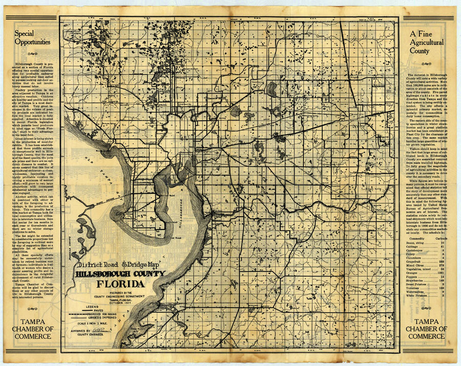
Description: Digitization provided by the USF Libraries Digitization Center. Rare Maps. This is a map of Hillsborough County, circa 1927. This map shows roads and bridges, railroads, cities and towns and inland waters. Section Township Range (STR) is shown. This map features two articles about Hillsborough county on each side of the map titled "Special Opportunities" and "A Fine Agricultural County". Measurements.Resolution: Scale [ca. 1:63360]
Place Names: Hillsborough, Citrus Park, Jackson Springs, Temple Terrace, Harney, Sulphur Springs, Thonotosassa, Lutz, Keystone, Rocky Point, Tampa, Plant City, Alafia, Limona, Valrico, Riverview, Bloomingdale, Hillsborough River, Alafia River, Gulf City, Ruskin, Wimauma, Tampa Bay,
ISO Topic Categories: inlandWaters, transportation, boundaries
Keywords: Hillsborough County Florida District Road and Bridge Map, historical, transportation, political, county borders, local jurisdictions, roads, railroads, inlandWaters, transportation, boundaries, Unknown,1927
Source: Hillsborough County Engineering Department, (Tampa, FL: Tampa Chamber of Commerce, 1927)
Map Credit: Courtesy of the Special Collections Department, University of South Florida. |
|
