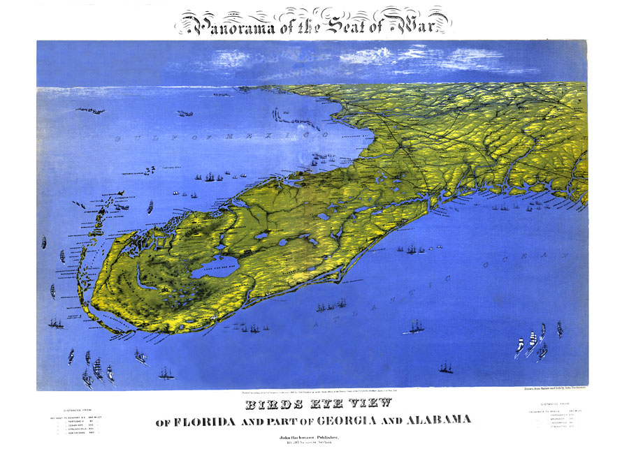
Description: Digitization provided by the USF Libraries Digitization Center. Rare Maps. This is a perspective map drawn from nature and lithography showing a bird's eye view of Florida during the Civil War, circa 1861. This map shows cities and towns as well as the terrain. Also shown are parts of Georgia and Alabama. Measurements.Dimensions: 57 x 72 cm
Place Names: 1860-1879, Amelia Island, Fernandina, Georgia, Anastasia Island, Saint Augustine, Tallahassee, Tampa, Cape Canaveral, Pensacola, Key West, Fort Lauderdale, Atlantic Ocean, Gulf of Mexico
ISO Topic Categories: inlandWaters, society
Keywords: Panorama of the seat of war of Florida and part of Georgia and Alabama, historical, physical, physical features, Civil War, inlandWaters, society, Unknown,1861
Source: John Bachmann, lithographer, (New York, NY: John Bachmann, 1861)
Map Credit: Courtesy of the Special Collections Department, University of South Florida. |
|