mapsExploring Florida
 FL Maps > State > 1860-1879 > Panorama of the seat of war of Florida and part of Georgia and Alabama, 1861
Site Map 

Panorama of the seat of war of Florida and part of Georgia and Alabama, 1861


Puzzle Directions: Click on a puzzle piece and drag it where you want it. When you connect two pieces correctly, they will join together. Mix up the pieces again. View finished map in pop-up window.

Title: Panorama of the seat of war of Florida and part of Georgia and Alabama
Projection: Unknown
Source Bounding Coordinates:
W: E: N: S:

Back to Map Page
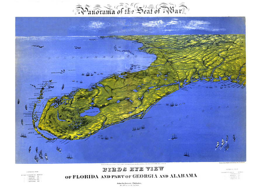
Description: Digitization provided by the USF Libraries Digitization Center. Rare Maps. This is a perspective map drawn from nature and lithography showing a bird's eye view of Florida during the Civil War, circa 1861. This map shows cities and towns as well as the terrain. Also shown are parts of Georgia and Alabama. Measurements.Dimensions: 57 x 72 cm
Source: John Bachmann, lithographer, (New York, NY: John Bachmann, 1861)
Map Credit: Courtesy of the Special Collections Department, University of South Florida.
SearchLicensePDF HelpGIS Help Google Earth Help Zoomify Help

 FL Maps > State > 1860-1879 > Panorama of the seat of war of Florida and part of Georgia and Alabama, 1861