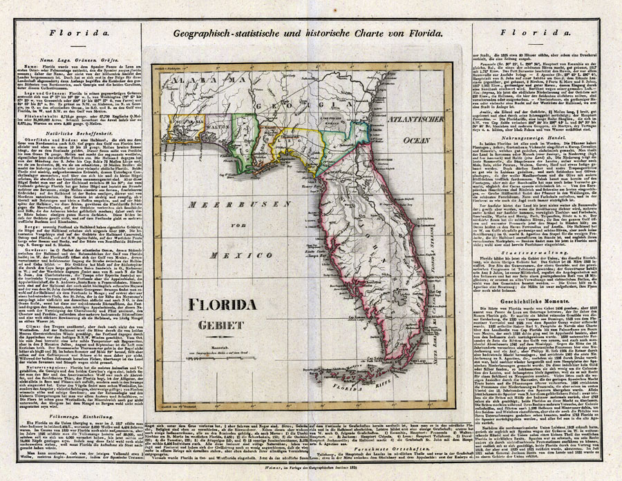
Description: Digitization provided by the USF Libraries Digitization Center. Rare Maps. This is a detailed map from Germany of Florida, circa 1828. This map shows railroads, counties, cities and towns and inland waters. The text around the map gives geographical, statistical and historical information about Florida. Measurements.Dimensions: 37 x 35 cm., on sheet 52 x 63 cm
Place Names: 1820-1839, Pensacola, Tallahassee, Jacksonville, Saint Augustine, Cape Canaveral, Tampa, Key West, Gulf of Mexico, Atlantic Ocean
ISO Topic Categories: transportation, boundaries, inlandWaters, oceans
Keywords: Geographisch-statistische und historische Charte von Florida, transportation, political, historical, county borders, railroads, transportation, boundaries, inlandWaters, oceans, Unknown,1828
Source: Geographisches Institut, (Weimar, : Verlag des Geographischen Instituts, 1828)
Map Credit: Courtesy of the Special Collections Department, University of South Florida. |
|