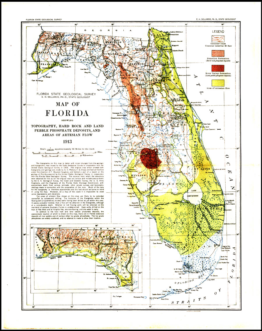
Description: Digitization provided by the USF Libraries Digitization Center. Rare Maps. This is a map of Florida showing topography, hard rock and land pebble phosphate deposits, and areas of artesian flow, circa 1913. This map includes a legend, informative text and an inset map of the western panhandle area of Florida. It also shows cities and towns, inland waters, railroads and canals. Measurements.Dimensions: 27 x 36 cm. Measurements.Resolution: Scale 1:2,000,000. Approx. 32 miles to the inch
Place Names: 1900-1919, Cape Canaveral, Tampa, Gulf of Mexico, Atlantic Ocean, Saint Augustine, Tallahassee, Gainesville, Jacksonville, Daytona Beach, Orlando, Sarasota, Fort Myers, Fort Lauderdale, Miami, Key West, Pensacola, West Palm Beach
ISO Topic Categories: inlandWaters, transportation, boundaries, geoscientificInformation, oceans, elevation
Keywords: Geological Map of Florida, transportation, historical, physical, political, physical features, geological, topographical, county borders, railroads, water routes, inlandWaters, transportation, boundaries, geoscientificInformation, oceans, elevation, Unknown,1913
Source: Elias Howard Sellards, Ph. D., state geologist, Florida State Geological Survey (Tallahassee, FL: A. Hoen & Co., 1913)
Map Credit: Courtesy of the Special Collections Department, University of South Florida. |
|