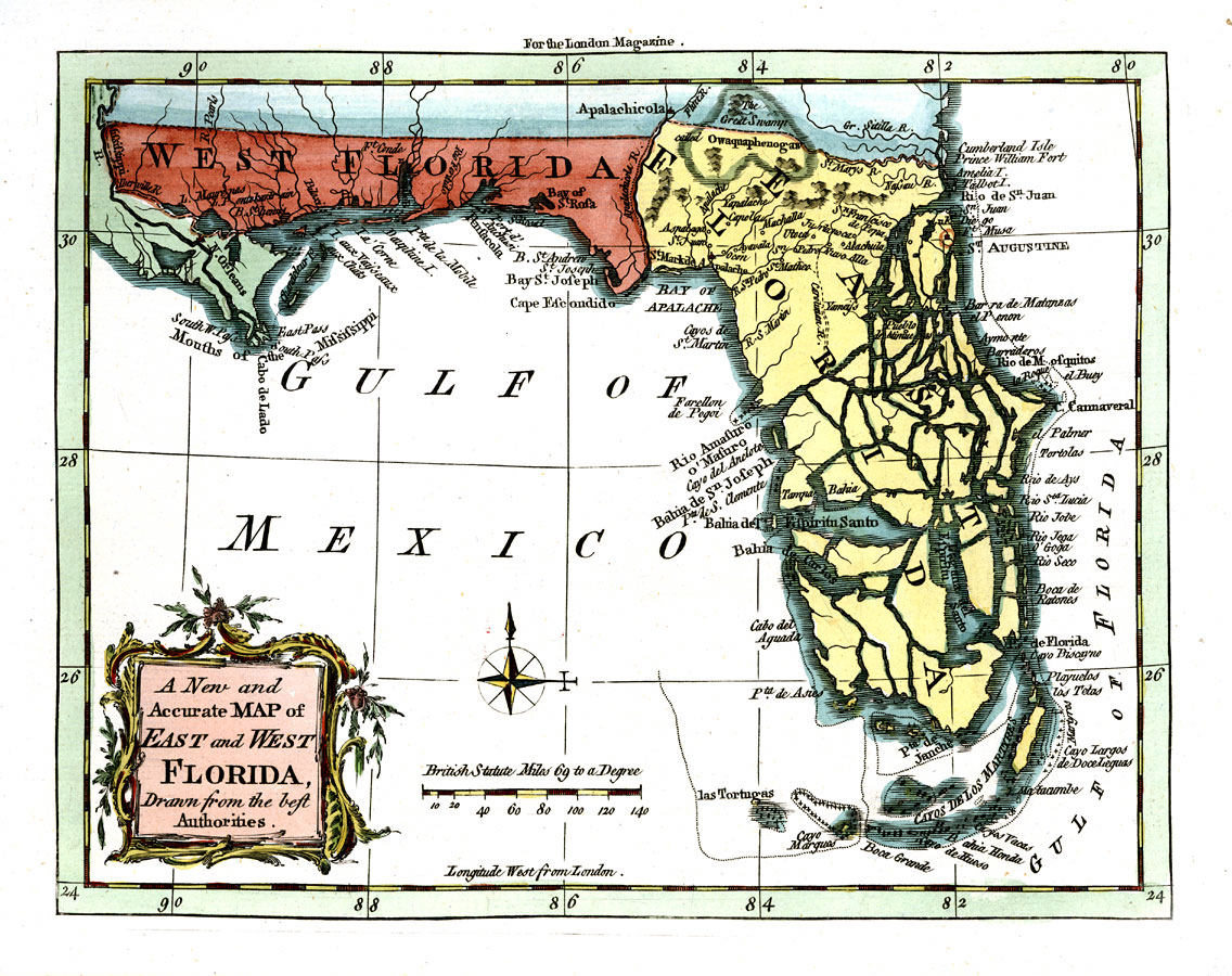
Description: Digitization provided by the USF Libraries Digitization Center. Rare Maps. This is a map of Florida showing the East and West portions, circa 1765. West Florida extends to the Mississippi River taking in New Orleans. This map also shows exaggerated intercoastal waterways, cities and towns. Measurements.Dimensions: 19 x 24 cm Measurements.Resolution: Scale ca. 1:5, 400,000
Place Names: 1760-1779, Gulf of Mexico, Atlantic Ocean, Pensacola, Saint Augustine, Cape Canaveral, Tampa, St. Josephs Bay, Espiritu Santo Bay, Key Biscayne
ISO Topic Categories: inlandWaters, oceans, boundaries
Keywords: A new and accurate map of East and West Florida drawn from the authorities, historical, physical, political, county borders, inlandWaters, oceans, boundaries, Unknown,1765
Source: J. Prockter, engraver, London Magazine, vol. 34 (London, : R. Baldwin, 1765)
Map Credit: Courtesy of the Special Collections Department, University of South Florida. |
|