mapsExploring Florida
 FL Maps > State > 1760-1779 > A new and accurate map of East and West Florida drawn from the authorities, 1765
Site Map 

A new and accurate map of East and West Florida drawn from the authorities, 1765


Puzzle Directions: Click on a puzzle piece and drag it where you want it. When you connect two pieces correctly, they will join together. Mix up the pieces again. View finished map in pop-up window.

Title: A new and accurate map of East and West Florida drawn from the authorities
Projection: Unknown
Source Bounding Coordinates:
W: -91 E: -81 N: 31 S: 25

Back to Map Page
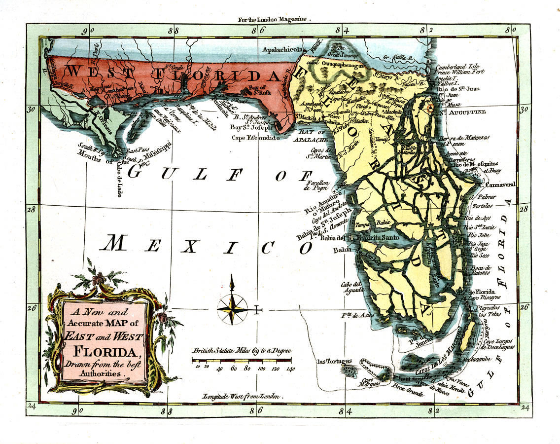
Description: Digitization provided by the USF Libraries Digitization Center. Rare Maps. This is a map of Florida showing the East and West portions, circa 1765. West Florida extends to the Mississippi River taking in New Orleans. This map also shows exaggerated intercoastal waterways, cities and towns. Measurements.Dimensions: 19 x 24 cm Measurements.Resolution: Scale ca. 1:5, 400,000
Source: J. Prockter, engraver, London Magazine, vol. 34 (London, : R. Baldwin, 1765)
Map Credit: Courtesy of the Special Collections Department, University of South Florida.
SearchLicensePDF HelpGIS Help Google Earth Help Zoomify Help

 FL Maps > State > 1760-1779 > A new and accurate map of East and West Florida drawn from the authorities, 1765