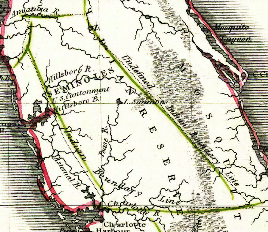
Description: Digitization provided by the USF Libraries Digitization Center. Rare Maps. This is a map of Seminole Indian Reserve, circa 1830. It is a portion of Rand McNally and Co.'s new business map of Florida. It shows county boundaries, unidentified Indian boundary lines, inland waters such as the Hillsboro or Hillsborough River, etc.
Place Names: State, Tampa Bay, Gulf of Mexico, reservation, Seminole
ISO Topic Categories: inlandWaters, oceans, boundaries
Keywords: Indian Reserve, historical, physical, political, physical features, county borders, inlandWaters, oceans, boundaries, Unknown,1830
Source: Joseph Meyer, Rand McNally and Co.'s new business map of Florida (and) Rand McNally and Co.'s indexed atlas of the world (Philadelphia, PA: Rand McNally and Co., 1830)
Map Credit: Courtesy of the Special Collections Department, University of South Florida. |
|