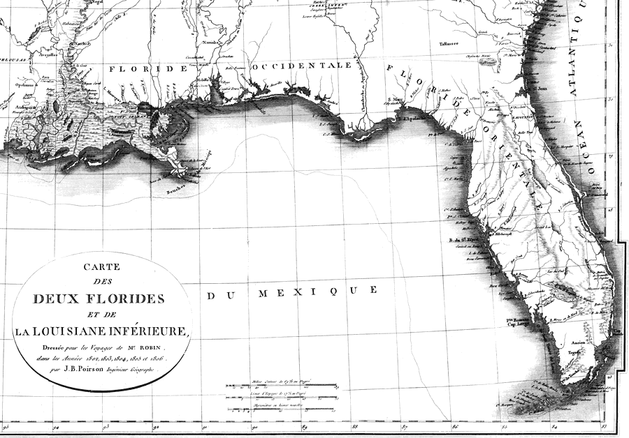
Description: A portion of Poirson's 1807 map showing East and West Florida. West Florida is shown extending from the Apalachicola River westward to the Mississippi River. Digitization provided by the USF Libraries Digitization Center. Rare Maps Collection: G3330 1807 .P6 Notes from USF Library: Relief shown pictorially. Prime meridian: Paris. "Tome II, page 612." Scale [ca. 1:3,674,880]; (W 104010’--W 81050’/N 34050’--N 24020’). Measurements.Dimensions: 39 x 67 cm., on sheet 45 x 69 cm.
Place Names: 1800-1819, Florida, Mexico, Texas, Lousiana, Alabama, Mississippi, Georgia, South Carolina, Gulf of Mexico, Atlantic Ocean, Floride Orientale, Floride Occidentale, Pensacola, Saint Augustine, Cape Canaveral
ISO Topic Categories: inlandWaters, oceans
Keywords: Carte des deux Florides et de la Louisiane inferieure: East and West Florida, physical, historical, physical features, topographical, inlandWaters, oceans, Unknown,1807
Source: J. B. Poirson, (Paris, : , 1807)
Map Credit: Courtesy of the Special Collections Department, University of South Florida. |
|
