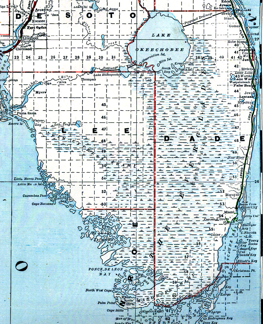
Description: A portion of Bradley’s commercial map of Florida detailing the southern tip of the peninsula and the Everglades. County lines and the township/range survey grid are shown. Note that much of the Everglades in Dade County were unsurveyed at the printing of this map (1889). Digitization provided by the USF Libraries Digitization Center. Rare Maps. This is a detailed map of Florida showing counties, railroads, cities, inland waters, etc. Includes grid. Scale [1:1,267,200]
Place Names: 1880-1899, Atlantic Ocean, Miami, West Palm Beach, Lake Okeechobee, Fort Lauderdale, Gulf of Mexico
ISO Topic Categories: inlandWaters, oceans, boundaries, transportation
Keywords: The Everglades, physical, historical, political, transportation, physical features, county borders, railroads, inlandWaters, oceans, boundaries, transportation, Unknown,1889
Source: Wm. M. Bradley and Bros., Bradley's atlas of the world for commercial and library reference (Philadelphia, PA: Wm. M. Bradley and Bros., 1889) 240-241
Map Credit: Courtesy of the Special Collections Department, University of South Florida. |
|