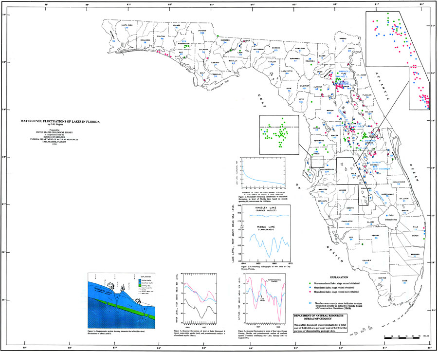
Description: This is a map showing the water-level fluctuations of lakes in Florida, current to 1974. The following is taken from the article "Water-Level Fluctuations of Lakes in Florida" by G. H. Hughes — "The freshwater lakes of Florida are of importance not only because they constitute sources of water supply, but also because they provide counties and diverse opportunities for camping, fishing, boating, swimming and other types of outdoor recreation." The green dots are non-meandering lakes, the blue are meandered lakes with stage record obtained, the red are meandered lakes with out the stage record, and the numbers represent number of lakes in county. Please see the article Water-Level Fluctuations of Lakes in Florida by G. H. Hughes for more information.
Source: U. S. Geological Survey, Bureau of Geology, Florida Department of Natural Resources , Florida Water Atlas (Tallahassee, FL: Bureau of Geology, 1976)
Map Credit: Courtesy the University of South Florida Library |
|