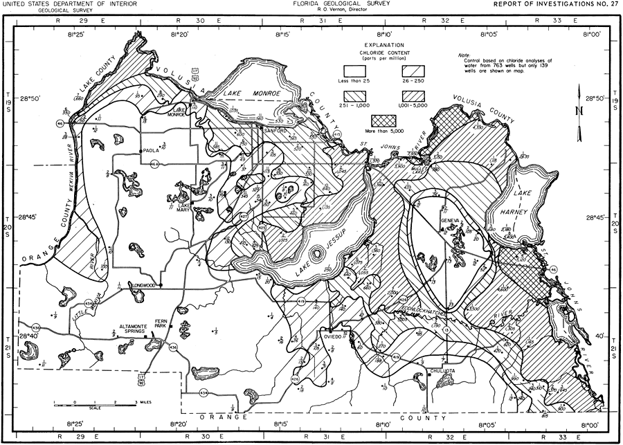
Description: This map shows the chloride content of water from the upper part of the Floridian aquifer in Seminole County, current to 1962. "Chloride (Cl) is abundant in sea water and is dissolved in small quantities from rocks. Water from the artesian aquifer beneath most of the hilly upland in Seminole County has a chloride content of less than 25 ppm, which might be considered normal for this part of central Florida. The chloride content of the 2,062 ground-water samples from the county ranged from 4 to 7,950 ppm." — Jack T. Barraclough, U. S. Geological Survey, 1962
Source: Jack T. Barraclough, U. S. Geological Survey, Ground-Water Resources of Seminole County, Florida (Tallahassee, FL: Florida Geological Survey, 1962)
Map Credit: Courtesy the University of South Florida Library |
|