mapsExploring Florida
 FL Maps > Region > 1950-1999 > Springs of the Lower Suwannee River Basin, 1999
Site Map 

Springs of the Lower Suwannee River Basin, 1999


Puzzle Directions: Click on a puzzle piece and drag it where you want it. When you connect two pieces correctly, they will join together. Mix up the pieces again. View finished map in pop-up window.

Title: Springs of the Lower Suwannee River Basin
Projection: Unknown
Source Bounding Coordinates:
W: -83.3 E: -82.15 N: 30.3 S: 29

Back to Map Page
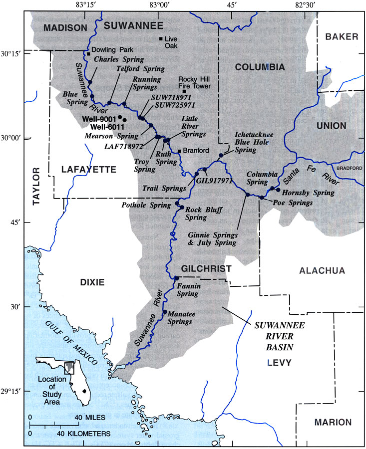
Description: This map from the U. S. Geological Survey Water Resources Investigation Report number 99-4252, Source and Chronology of Nitrate Contamination in Spring Waters, Suwannee River Basin, shows the location of major springs and well sites used in the study along the Suwannee River and Santa Fe River.
Source: B. G. Katz, H. D. Hornsby, J. F. Bohlke, and M. F. Mokray, USGS Water Resources Investigations Report 99-4252 (Tallahassee, FL: U. S. Geological Survey, 1999) 3
Map Credit: Courtesy the University of South Florida Library
SearchLicensePDF HelpGIS Help Google Earth Help Zoomify Help

 FL Maps > Region > 1950-1999 > Springs of the Lower Suwannee River Basin, 1999