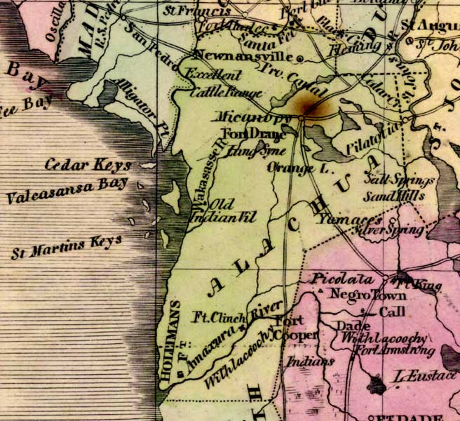
Description: This detail of a 1842 map of Florida shows roads, railroads, counties, forts, naval depots and other military installations, major towns, rivers, and lakes for Alachua County. Many inland waters are depicted such as the Amaxura River, the Santa Fe River, and Orange Lake. Some of the larger towns that are shown are Newnansville and Micanopy. Longitude is shown from Greenwich at the top of the map, and Washington at the bottom of the map. The map scale is in &quoe;American Miles."
Place Names: Alachua, Newnansville, Fort Clinch, Hollimans, Amaxura River, Santa Fe River, Cedar Creek, Micanopy, Pilatotia, Orange Lake, Withlacoochee, Wakasasse River, Fort Drane, Cedar Keys, Saint Martins Keys,
ISO Topic Categories: boundaries, inlandWaters, oceans, society
Keywords: Detail - Map of the State of Florida, physical, political, transportation, historical, physical features, major political subdivisions, county borders, roads, boundaries, inlandWaters, oceans, society, Unknown,1842
Source: Jeremiah Greenleaf, A New Universal Atlas (Brattleboro, VT: , 1842) 56
Map Credit: Courtesy the private collection of Roy Winkelman |
|