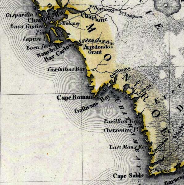
Description: Meyer's 1850 map of Florida is derived from the Tanner/Mitchell Universal atlas map of 1839, and similar to the 1845 maps. In this updated detail of the mainland of Monroe County, waterways and townships are noted. Coastal features shown include Charlotte Harbor, Cape Roman, Gallivans Bay, and Cape Sable.
Place Names: Monroe, Charlotte Harbor, Boca Captive, Sanybell, Bay Carlos, Cape Roman, Cape Romano, Gallivans Bay, Chatham Bay, North River, Youngs River, Pavillon Key, Chersonese Point, Last Mans Key, Cape Sable
ISO Topic Categories: boundaries, inlandWaters, oceans, society, transportation
Keywords: Monroe County- Mainland, physical, political, transportation, historical, physical features, major political subdivisions, roads, boundaries, inlandWaters, oceans, society, transportation, Unknown,1850
Source: Joseph Meyer, Grosser Hand-Atlas uber alle Theile der Erde (Hillsburghaus, : Hildburghausen: Bibliographischen Instituts, 1850) 148
Map Credit: Courtesy the private collection of Roy Winkelman |
|