|
|
|
| FL Maps > State > 1780-1799 |
|
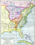
Division of the West,
1782 |
|
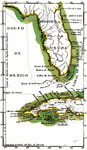
Florida,
1783 |
|
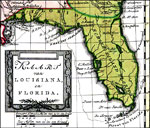
Kaart van Louisians, en Florida,
1785 |
|
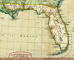
Detail of Florida from A New and General Map of the Southern Dominions Belonging to the United States of America,
1794 |
| FL Maps > State > 1780-1799 |
Maps ETC
is a part of the
Educational Technology Clearinghouse
Produced by the
Florida Center for Instructional Technology
© 2007
College of Education
,
University of South Florida