|
|
|
| FL Maps > Region > 1880-1899 |
|
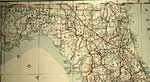
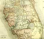
Detail - Florida,
1889 |
|
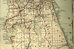
Detail - Florida,
1889 |
|
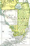
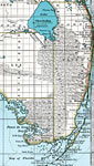
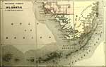
Everglades and South Florida,
1890 |
|
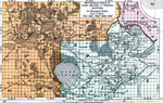
Phosphate Plants of Manatee, Polk, Lee, and Hillsborough,
1891 |
|
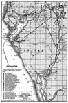
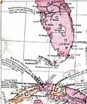
Lake Okeechobee and Everglades,
1897 |
|
Map Showing Parts of Lake, Orange and Volusia Counties,
1898 |
|
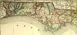
Detail - Florida,
1898 |
|
Detail - Florida,
1898 |
|
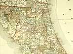
Detail - Florida,
1898 |
|
Detail - Florida,
1898 |
|
Detail - Goff's historical map of the Spanish-American War in the West Indies,
1899 |
| First | Previous |
| FL Maps > Region > 1880-1899 |
Maps ETC
is a part of the
Educational Technology Clearinghouse
Produced by the
Florida Center for Instructional Technology
© 2007
College of Education
,
University of South Florida