|
|
|
| FL Maps > County > Gulf |
Click on a thumbnail image to view a full size version of that map.
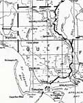
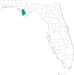
Gulf County is Florida's 66th county, established on June 6, 1925, from a segment of Calhoun County. It gains its name from the Gulf of Mexico. Port Saint Joe, originally known as St. Joseph, and the place where Florida's first constitution was written in 1838, is the county seat.
For earlier maps of this area, visit the Calhoun County map gallery.
|
Gulf County,
1932 |
|
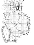
Gulf,
1936 |
|
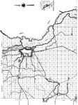
North Gulf,
1936 |
|
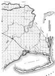
South Gulf,
1936 |
|
Locater Map of Gulf County,
2008 |
|
Clipart Collection: Gulf County Maps in 50 Colors,
2008 |
|
Plain Frames Collection: Gulf County Maps in 30 Colors,
2008 |
|
Fancy Frames Collection: Gulf County Maps in 30 styles,
2008 |
|
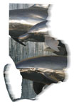
Florida Photo Collection: Gulf County Maps in 30 styles,
2008 |

|
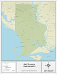
Florida Waterways: Gulf County Outline,
2008 |
|
Florida Waterways: Gulf County ,
2008 |
|
Florida Waterways: Gulf County Outline without Labels,
2008 |

|
Gulf "Abstract" Style Maps in 30 Styles,
2008 |

|
Gulf County "Fun" Maps in 30 Styles,
2008 |
|
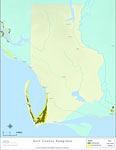
Florida Seagrass: Gulf,
2008 |
|
Gulf County Cities with Labels,
2009 |
|
Gulf County Cities Outline,
2009 |
|
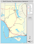
Gulf County Road Network- Black and White,
2009 |
|
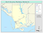
Gulf County Railway Network- Black and White,
2009 |
|
Gulf County Railway Network- Color,
2009 |
|
Gulf County Road Network- Color,
2009 |
| FL Maps > County > Gulf |
Maps ETC
is a part of the
Educational Technology Clearinghouse
Produced by the
Florida Center for Instructional Technology
© 2007
College of Education
,
University of South Florida