|
|
|
| FL Maps > County > Sumter |
Click on a thumbnail image to view a full size version of that map.
Sumter County is Florida's 29th county, established on January 8, 1853, from a segment of Orange County. It gains its name from Thomas Sumter (1736-1832), a prominent general of southern campaigns during the Revolutionary War. Bushnell is the county seat.
For earlier maps of this area, visit the Orange County map gallery.
|
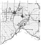
North Sumter,
1936 |

|
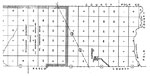
Sumter,
1936 |
|
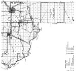
South Sumter,
1936 |
|
Mid Sumter,
1936 |
|
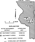
Water Management Districts and Hydrologic Units for Sumter County,
1981 |
|
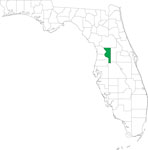
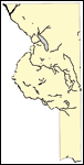
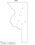
Locater Map of Sumter County,
2008 |

|
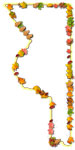
Clipart Collection: Sumter County Maps in 50 Colors,
2008 |

|
Plain Frames Collection: Sumter County Maps in 30 Colors,
2008 |
|
Fancy Frames Collection: Sumter County Maps in 30 styles,
2008 |
|
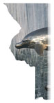
Florida Photo Collection: Sumter County Maps in 30 styles,
2008 |
|
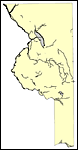
Florida Waterways: Sumter County Outline,
2008 |
|
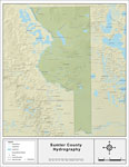
Florida Waterways: Sumter County ,
2008 |
|
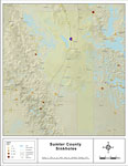
Sinkholes of Sumter County, Florida ,
2008 |
|
Florida Waterways: Sumter County Outline without Labels,
2008 |

|
Sumter "Abstract" Style Maps in 30 Styles,
2008 |

|
Sumter County "Fun" Maps in 30 Styles,
2008 |
|
Sumter County Cities with Labels,
2009 |
|
Sumter County Cities Outline,
2009 |
|
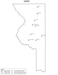
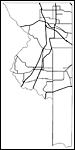
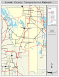
Sumter County Road Network- Black and White,
2009 |
|
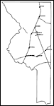
Sumter County Railway Network- Black and White,
2009 |
|
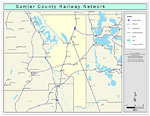
Sumter County Railway Network- Color,
2009 |
|
Sumter County Road Network- Color,
2009 |
|
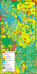
Withlacoochee River Watershed Distribution of 1995 Land Use/Cover- Sumter County,
May 9, 2001 |
|
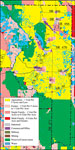
Withlacoochee River Watershed Distribution of Generalized Future Land Use, Ca. 2010- Sumter County,
May 9, 2001 |
|
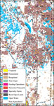
Withlacoochee River Watershed Distribution of 1995 Agricultural Land Use/Cover- Sumter County,
May 9, 2001 |
| First | Previous | Next | Last |
| FL Maps > County > Sumter |
Maps ETC
is a part of the
Educational Technology Clearinghouse
Produced by the
Florida Center for Instructional Technology
© 2007
College of Education
,
University of South Florida