|
|
|
| FL Maps > County > Taylor |
Click on a thumbnail image to view a full size version of that map.
Taylor County is Florida's 34th county, established on December 23, 1856, from a segment of Madison County. It gains its name from Zachary Taylor, the 12th President of the United States (1849-1850), who commanded forces during the Second Seminole War. Perry, originally called Rosehead by Native Americans and then later (1875) renamed Perrytown after Governor Stark Perry, is the county seat.
For earlier maps of this area, visit the Madison County map gallery.
|
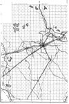
North Taylor,
1936 |
|
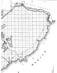
South Taylor,
1936 |
|
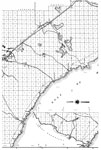
Mid Taylor,
1936 |
|
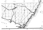
Northwest Taylor,
1936 |
|
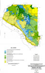
General Soils Map of Taylor County,
1998 |
|
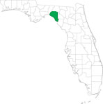
Locater Map of Taylor County,
2008 |
|
Clipart Collection: Taylor County Maps in 50 Colors,
2008 |
|
Plain Frames Collection: Taylor County Maps in 30 Colors,
2008 |
|
Fancy Frames Collection: Taylor County Maps in 30 styles,
2008 |

|
Florida Photo Collection: Taylor County Maps in 30 styles,
2008 |
|
Florida Waterways: Taylor County Outline,
2008 |
|
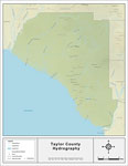
Florida Waterways: Taylor County ,
2008 |
|
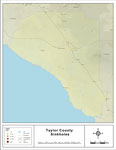
Sinkholes of Taylor County, Florida ,
2008 |
|
Florida Waterways: Taylor County Outline without Labels,
2008 |

|
Taylor "Abstract" Style Maps in 30 Styles,
2008 |

|
Taylor County "Fun" Maps in 30 Styles,
2008 |
|
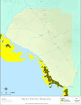
Florida Seagrass: Taylor,
2008 |
|
Taylor County Cities with Labels,
2009 |
|
Taylor County Cities Outline,
2009 |
|
Taylor County Road Network- Black and White,
2009 |
|
Taylor County Railway Network- Black and White,
2009 |
|
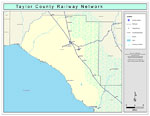
Taylor County Railway Network- Color,
2009 |
|
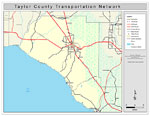
Taylor County Road Network- Color,
2009 |
| First | Previous |
| FL Maps > County > Taylor |
Maps ETC
is a part of the
Educational Technology Clearinghouse
Produced by the
Florida Center for Instructional Technology
© 2007
College of Education
,
University of South Florida