|
|
|
| FL Maps > Region > 1950-1999 |
|
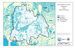
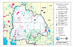
Hillsborough River Watershed Distribution of FEMA 100-Year Flood Zones- Map 11,
October 1, 1999 |
|
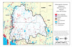
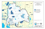
Hillsborough River Watershed Distribution of 1990 Urban Land Use Within the FEMA 100-Year Flood Plan- Map 12,
October 1, 1999 |
|
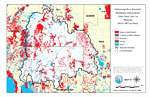
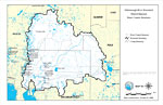
Hillsborough River Watershed Distribution of Generalized Urban Future Land Use Within the 100-Year Flood Plan- Map 13,
October 1, 1999 |
|
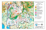
Hillsborough River Watershed Distribution of Natural Systems 1990- Map 14,
October 11, 1999 |
|
Hillsborough River Watershed Water Use Permits 1996 Estimated Daily Average Withdrawals (GPD)- Map 19,
October 11, 1999 |
|
Hillsborough River Watershed District Operated Water Control Structures- Map 18,
October 14, 1999 |
|
Hillsborough River Watershed Distribution of Public Supply Wellfields- Map 17,
October 18, 1999 |
|
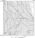
Groundwater Movement in the Intermediate Aquifer System in Hardee and De Soto Counties,
September 1988 |
|
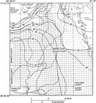
Groundwater Movement in the Upper Floridan Aquifer System in Hardee and De Soto Counties,
September 1988 |
|
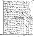
Groundwater Movement in the Intermediate Aquifer System in Hardee and De Soto Counties,
September 1989 |
|
Groundwater Movement in the Upper Floridan Aquifer System in Hardee and De Soto Counties,
September 1989 |
| First | Previous |
| FL Maps > Region > 1950-1999 |
Maps ETC
is a part of the
Educational Technology Clearinghouse
Produced by the
Florida Center for Instructional Technology
© 2007
College of Education
,
University of South Florida