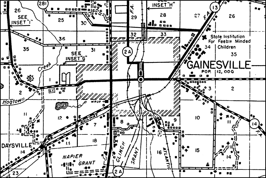
Description: This is a detailed map of the city Gainesville in Alachua County, Florida. Section Township Range (STR) is shown. This map shows state roads (2 A, 281, 13 and 14), federal aid highways, railroads, corporate lines, inland waters, schools, tenant houses, tanks, churches, businesses, farm units, radio station (WRUF), post offices, cemeteries, state road department shop, hospitals, tourist camp, airports, golf courses and dwellings other than farms. Key to Florida Highway maps.
Place Names: Alachua, Gainsville, Napier Grant, Clinch Grant, Daysville, Hogtown Creek
ISO Topic Categories: boundaries, inlandWaters, location, transportation
Keywords: Gainesville, physical, political, transportation, physical features, major political subdivisions, local jurisdictions, roads, railroads, boundaries, inlandWaters, location, transportation, Unknown,1936
Source: , Florida State Road Department (, FL: , 1936)
Map Credit: Courtesy the private collection of Roy Winkelman. |
|