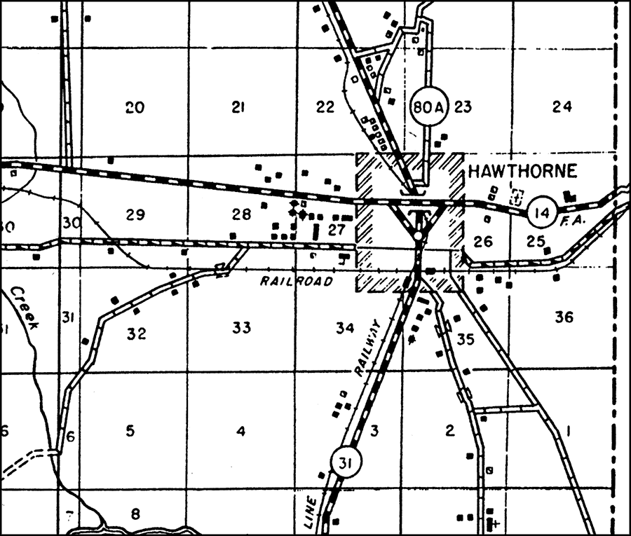
Description: This is a detailed map of the city Hawthorne in Alachua County, Florida. Section Township Range (STR) is shown. This map shows state roads (31, 80 A and 14), federal aid highways, railroads, inland waters, corporate lines, cemeteries, schools, tenant houses, churches, businesses, farm units and dwellings other than farms. Key to Florida Highway maps.
Place Names: Alachua, Hawthorne, Lochloosa Creek, Lochloosa Lake
ISO Topic Categories: boundaries, inlandWaters, location, transportation
Keywords: Hawthorne, physical, political, transportation, physical features, major political subdivisions, local jurisdictions, roads, railroads, boundaries, inlandWaters, location, transportation, Unknown,1936
Source: , Florida State Road Department (, FL: , 1936)
Map Credit: Courtesy the private collection of Roy Winkelman. |
|