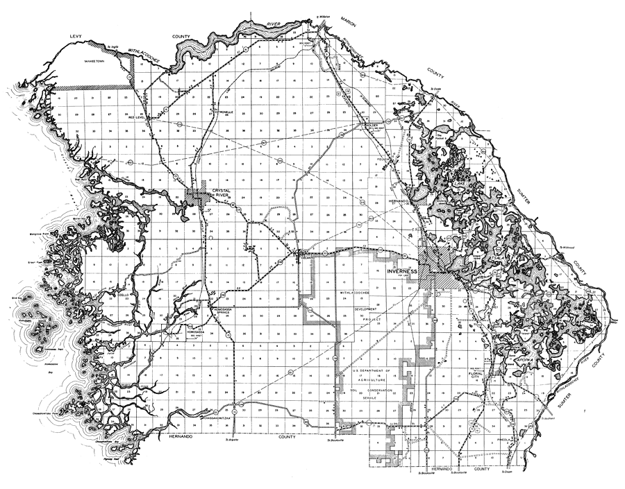
Description: This is a detailed map of the county of Citrus in the state of Florida. Section Township Range (STR) is shown. This map shows all of the main cities, state roads, US Highways, bridge highways, drawbridge highways, federal aided highway, federal aided secondary highway, saw mills, railroads, inland waters, canals, ferries, corporate lines, county boundary, county seat, camp or lodge, post offices, monuments, mines, turpentine still, cemeteries, churches, farm units, dwellings other than farms, tenant houses, businesses, townhalls, hotels, schools, hospitals and factories. Key to Florida Highway maps.
Place Names: Citrus, Citronelle, Withlacoochee River, Crystal River, Inverness, Hernando, Holder, Withlacoochee, Lecanto, Floral City, Felicia, Lake Tsala Apopka, Homosassa, Homosassa Islands, Chassahowitzka River, Chassahowitzka Bay, Ozello, Gulf of Mexico
ISO Topic Categories: boundaries, inlandWaters, transportation, location
Keywords: Citrus, physical, political, transportation, physical features, major political subdivisions, county borders, local jurisdictions, roads, railroads, boundaries, inlandWaters, transportation, location, Unknown,1936
Source: , Florida State Road Department (, FL: , 1936)
Map Credit: Courtesy the private collection of Roy Winkelman. |
|