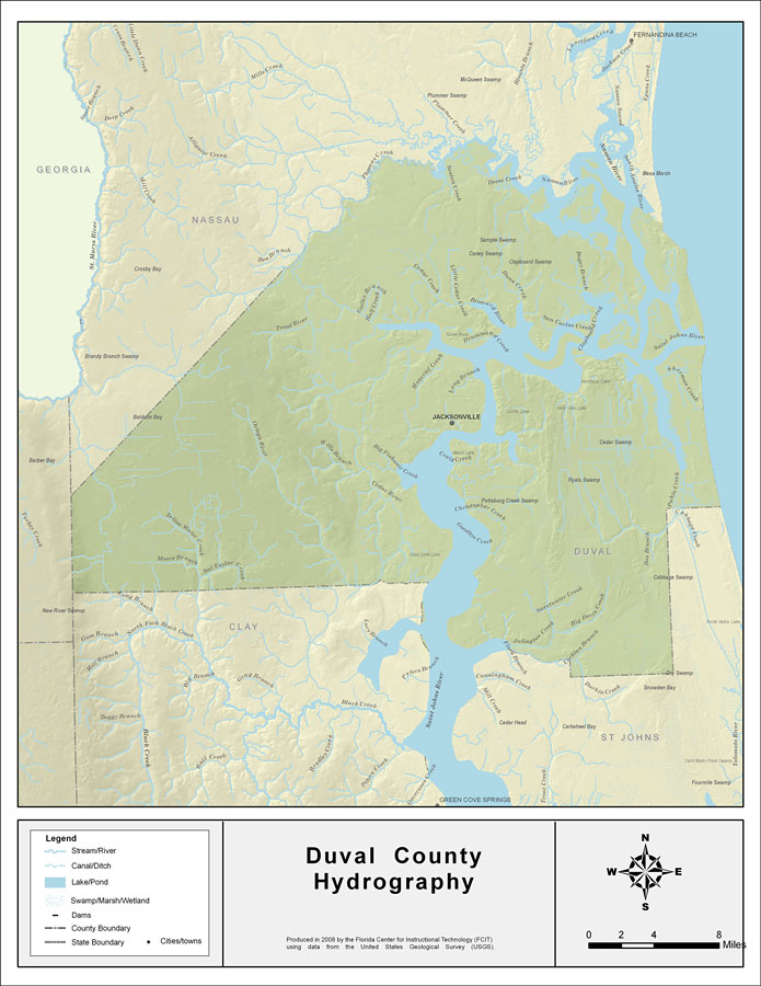
Description: This map was created by FCIT and shows the waterways of Duval County. All major rivers, streams, creeks, lakes, and swamps are labeled. This map features Seaton Creek, Inconstation Creek, Deese Creek, Burton Creek, Nassau River, Bogey Branch, Dunn Creek, Rushing Branch, Little Cedar Creek, Cedar Creek, Gulley Branch, Half Creek, Trout River, Thomas Creek, Little Sixmile Creek, Cedar River, Wills Branch, Ortega River, Big Fishweir Creek, St. Johns River, Miller Creek, New Rose Creek, Long Branch, Ginhouse Creek, Newcastle Creek, Mount Pleasant Creek, Greenfield Creek, Sheman Creek, Christopher Creek, Sweetwater Creek, Big Davis Creek, Durbin Creek, Julington Creek, Oldfield Creek, Butcher Pen Creek, Sal Taylor Creek, Yellow Water Creek, Pablo Creek, and Boggy Branch.
Source: Florida Center for Instructional Technology, (Tampa, FL: University of South Florida, 2008)
Map Credit: Courtesy of the Florida Center for Instructional Technology |
|