mapsExploring Florida
 FL Maps > County > Sumter > Florida Waterways: Sumter County , 2008
Site Map 

Florida Waterways: Sumter County , 2008


Puzzle Directions: Click on a puzzle piece and drag it where you want it. When you connect two pieces correctly, they will join together. Mix up the pieces again. View finished map in pop-up window.

Title: Florida Waterways: Sumter County
Projection:
Source Bounding Coordinates:
W: E: N: S:

Back to Map Page
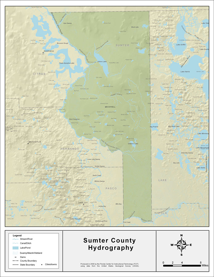
Description: This map was created by FCIT and shows the waterways of Sumter County. All major rivers, streams, creeks, lakes, and swamps are labeled. This map features Gum Slough, Withlacoochee River South, Little Jones Creek, Johns Lake, Jumper Creek, Big Prairie, Giddon Lake, Little Withlacoochee River, Cross Creek, Withlacoochee River, and Tiger Branch.
Source: Florida Center for Instructional Technology, (Tampa, FL: University of South Florida, 2008)
Map Credit: Courtesy of the Florida Center for Instructional Technology
SearchLicensePDF HelpGIS Help Google Earth Help Zoomify Help

 FL Maps > County > Sumter > Florida Waterways: Sumter County , 2008