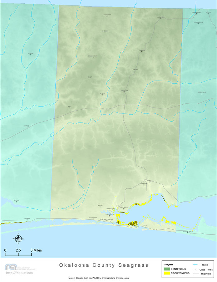
Description: This topographical map was created by FCIT and shows the seagrass distribution for Okaloosa County. The green coloration depicts continuous seagrass while the yellow shows discontinuous seagrass. In addition to the seagrass, rivers, towns, and highways are shown. Some of the towns are Shalimar, Laurel Hill, and Destin. The data used for this map was taken from a 1992 United States Geological Survey (USGS).
Source: Florida Center for Instructional Technology, Florida Fish and Wildlife Conservation Commission (Tampa, FL: University of South Florida, 2008)
Map Credit: Courtesy of the Florida Center for Instructional Technology |
|