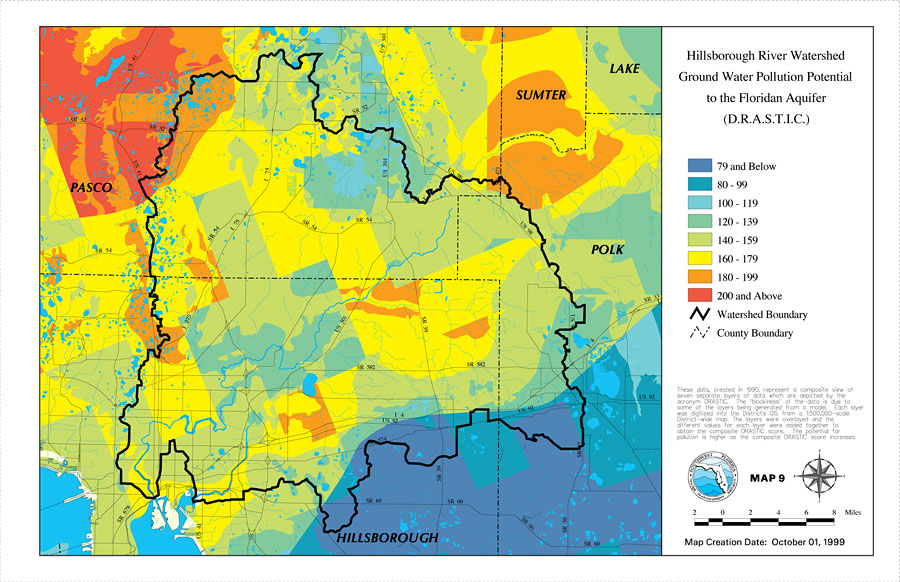
Description: This is a map from the Southwest Florida Watershed Management District or SWFWMD of the Hillsborough River ground water pollution potential to the Floridian aquifer created on October 1, 1999. The pollution potential is shown with a composite DRASTIC score from least to greatest by color; Blue is the least and red is the most. It also shows the Watershed Management boundary shown by the thick black line, US/State roads, inland water and county boundaries. "These data created in 1990, represent a composite view of seven separate layers of data which are depicted by the acronym DRASTIC. The "blockiness" of the data is due to some of the layers being generated from a model. Each layer was digitized into the district's GIS from a 1:500,000 scale District-wide map. The layers were overlayed and the different values for each layer were added together to obtain the composite DRASTIC score. The potential for pollution is higher as the composite DRASTIC score increases." —Southwest Florida Watershed Management District
Place Names: 1950-1999, Hillsborough River, �Hillsborough, �Polk, �Pasco, �Sumter, �Lake
ISO Topic Categories: boundaries, �inlandWaters, �transportation, �geoscientificInformation
Keywords: Hillsborough River Watershed Ground Water Pollution Potential to the Floridian Aquifer (D.R.A.S.T.I.C.)- Map 9, physical, �political, �transportation, �hydrological, �watershed, �kwatershed, physical features, county borders, roads, boundaries, �inlandWaters, �transportation, �geoscientificInformation, Unknown,October 1, 1999
Source: Southwest Florida Water Management District, Hillsborough River Comprehensive Watershed Management Plan Atlas (Brooksville, FL: Southwest Florida Water Management District, 2000)
Map Credit: Courtesy of the Southwest Florida Water Management District |
|