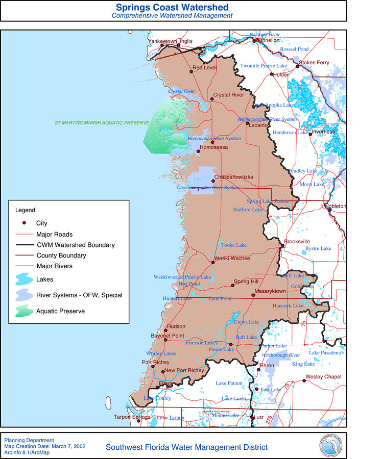
Description: This is a map from the Southwest Florida Watershed Management District or SWFWMD of the Springs Coast watershed, created on March 7, 2002. This map shows the Comprehensive Watershed Management or CWM boundary, outstanding Florida waters (OFW, Special) highlighted in lavender, and aquatic preserves in green. It also shows surrounding cities, major roads, rivers and lakes and county boundaries.
Place Names: 2000-, Springs Coast, �Red Level, �Crystal River, �Lecanto, �Homosassa, �Chassahowitzka, �Weeki Wachee, �Masaryktown, �Wesley Chapel, �Port Richey, �New Port Richey, �Spring Hill, �Dunnellon, �Brooksville, �Tarpon Springs, �Hillsborough River, �Crews Lake, �St. Martins Marsh Aquatic Preserve, �Lutz, �Rainbow River, �Apopka Lake, �Inverness
ISO Topic Categories: boundaries, �inlandWaters, �transportation, �geoscientificInformation
Keywords: Springs Coast Watershed- Comprehensive Watershed Management, physical, �political, �transportation, �hydrological, �watershed, �kwatershed, physical features, county borders, roads, boundaries, �inlandWaters, �transportation, �geoscientificInformation, Unknown,March 7, 2002
Source: Southwest Florida Water Management District, (Brooksville, FL: Southwest Florida Water Management District, March 7, 2002)
Map Credit: Courtesy of the Southwest Florida Water Management District |
|