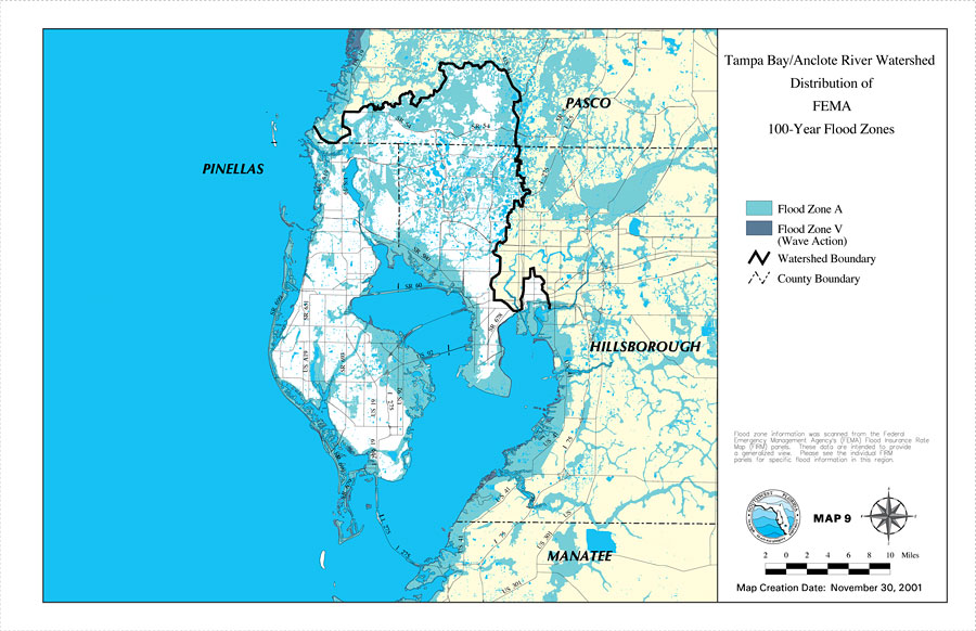
Description: This is a map from the Southwest Florida Watershed Management District or SWFWMD of the Tampa Bay/Anclote River watershed distribution of FEMA 100-year flood zones, created on November, 2001. Flood Zone A is shown in teal and Flood Zone V (wave action) is shown in dark blue. It also shows the Watershed Management boundary shown by the thick black line, US/State roads, inland water and county boundaries. "Flood zone information was scanned from the Federal Emergency Management Agency's (FEMA) Flood Insurance Rate Map (FIRM) panels. These data are intended to provide a generalized view. Please see the individual FIRM panels for specific flood information in this region." —Southwest Florida Watershed Management District
Place Names: 2000-, counties, �Pasco, �Tampa Bay, �Anclote River, �Hillsborough, �Manatee, �Pinellas
ISO Topic Categories: boundaries, �geoscientificInformation, �inlandWaters, �transportation
Keywords: Tampa Bay/Anclote River Watershed Distribution of FEMA 100-Year Flood Zones, physical, �political, �transportation, �hydrological, �watershed, �kwatershed, physical features, county borders, roads, boundaries, �geoscientificInformation, �inlandWaters, �transportation, Unknown,November 30, 2001
Source: Southwest Florida Water Management District, Tampa Bay/Anclote River Comprehensive Watershed Management Plan Atlas (Brooksville, FL: Southwest Florida Water Management District, 2001)
Map Credit: Courtesy of the Southwest Florida Water Management District |
|