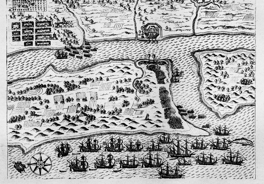
Description: Map shows St. Augustine's layout with re gards to the placement of the ships in the river near the fort, the placement of the city and buildings in it and the placement of troops around the fort and city. Shows landscape and agriculture around the fort and city.
Place Names: Before 1700, Saint Augustine
ISO Topic Categories: inlandWaters, society, structure, farming
Keywords: EXPVGNATIO CIVTATIS S. AV., physical, historical, hydrological, physical features, inlandWaters, society, structure, farming, Unknown,1586
Source: Charles B. Reynolds, Old Saint Augustine (St. Augustine, FL: E. H. Reynolds, 1888) 50
Map Credit: Courtesy the private collection of Roy Winkelman |
|