Maps Site map
  FL Maps > Region > before 1700
Site Map  

  Record   1   to   5  of   5

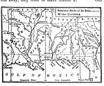
Route of De Soto, 1539
Map shows the landing site of Hernando De Soto at Tampa Bay and the route he traveled to explore the southeastern states of the U.S. It shows locations of major rivers he found and the Gulf of Mexico....

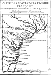
Map of French Florida Colony, 1562
Map shows the French governed colonies in Florida and easther U.S. during 1562 C.E. and through 1565 C.E. Shows all major rivers during this period in history. ...

Old St. Augustine, 1565
Map showing Fort Caroline on the River of May. Shows San Augustin located on the newly named River San Augustin....

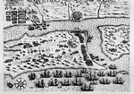
EXPVGNATIO CIVTATIS S. AV., 1586
Map shows St. Augustine's layout with re gards to the placement of the ships in the river near the fort, the placement of the city and buildings in it and the placement of troops around the fort and city. Shows landscape and agriculture around the fo...

Old St. Augustine, August 29, 1565
Map shows hisorical Fort Caroline located off of the River of May and the River of Dolphins. Map was drawn in 1565 shortly after Fort Caroline was built. ...


  FL Maps > Region > before 1700
Site Map  

Maps ETC is a part of the Educational Technology Clearinghouse
Produced by the Florida Center for Instructional Technology © 2007
College of Education , University of South Florida