mapsExploring Florida
 FL Maps > Region > Before 1700 > EXPVGNATIO CIVTATIS S. AV., 1586
Site Map 

EXPVGNATIO CIVTATIS S. AV., 1586


Puzzle Directions: Click on a puzzle piece and drag it where you want it. When you connect two pieces correctly, they will join together. Mix up the pieces again. View finished map in pop-up window.

Title: EXPVGNATIO CIVTATIS S. AV.
Projection: Unknown
Source Bounding Coordinates:
W: E: N: S:

Back to Map Page
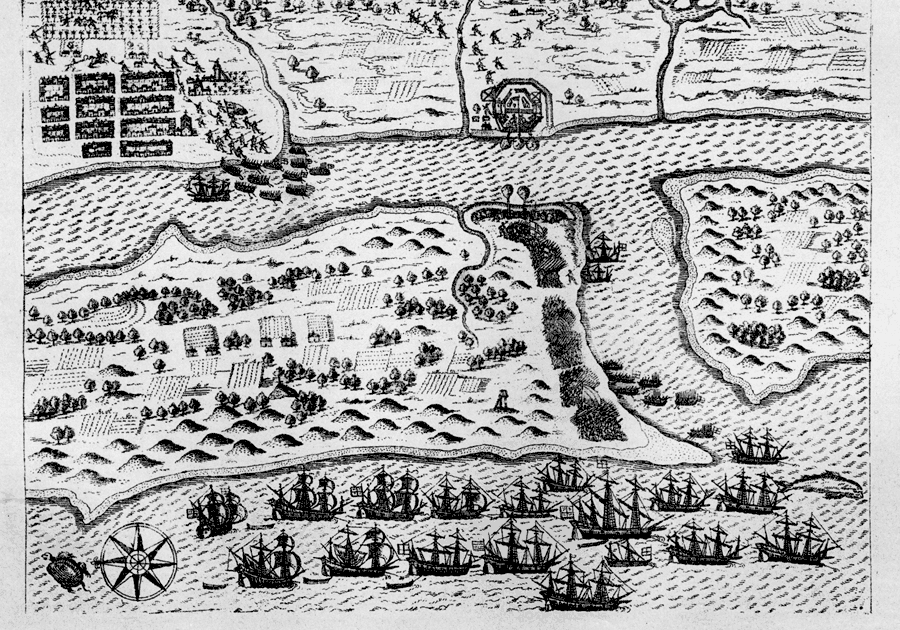
Description: Map shows St. Augustine's layout with re gards to the placement of the ships in the river near the fort, the placement of the city and buildings in it and the placement of troops around the fort and city. Shows landscape and agriculture around the fort and city.
Source: Charles B. Reynolds, Old Saint Augustine (St. Augustine, FL: E. H. Reynolds, 1888) 50
Map Credit: Courtesy the private collection of Roy Winkelman
SearchLicensePDF HelpGIS Help Google Earth Help Zoomify Help

 FL Maps > Region > Before 1700 > EXPVGNATIO CIVTATIS S. AV., 1586