mapsExploring Florida
 FL Maps > State > 2000- > Harmful Algal Blooms, 1972
Site Map 

Harmful Algal Blooms, 1972


Puzzle Directions: Click on a puzzle piece and drag it where you want it. When you connect two pieces correctly, they will join together. Mix up the pieces again. View finished map in pop-up window.

Title: Harmful Algal Blooms
Projection: Unknown
Source Bounding Coordinates:
W: E: N: S:

Back to Map Page
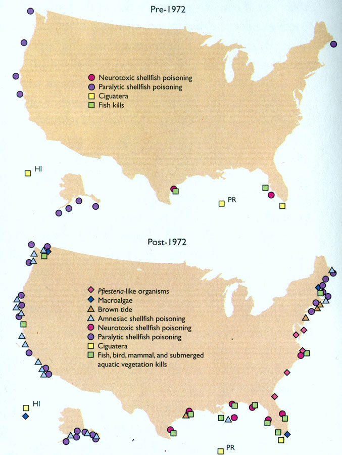
Description: Map indicates the affects of algal blooms in the waters around the U.S. from 1972 to present. Map lists such examples as Macroalgae, Ciguatera, fish kills, Paralyic shellfish poisoning, and more.
Source: , National Coastal Condition Report II (Washington, DC: Environmental Protection Agency, 2004) 42
Map Credit: Courtesy the private collection of Roy Winkelman
SearchLicensePDF HelpGIS Help Google Earth Help Zoomify Help

 FL Maps > State > 2000- > Harmful Algal Blooms, 1972