mapsExploring Florida
 FL Maps > Local > Nassau > Map of the Entrance to Cumberland Sound, 1891
Site Map 

Map of the Entrance to Cumberland Sound, 1891


Puzzle Directions: Click on a puzzle piece and drag it where you want it. When you connect two pieces correctly, they will join together. Mix up the pieces again. View finished map in pop-up window.

Title: Map of the Entrance to Cumberland Sound
Projection: Unknown
Source Bounding Coordinates:
W: E: N: S:

Back to Map Page
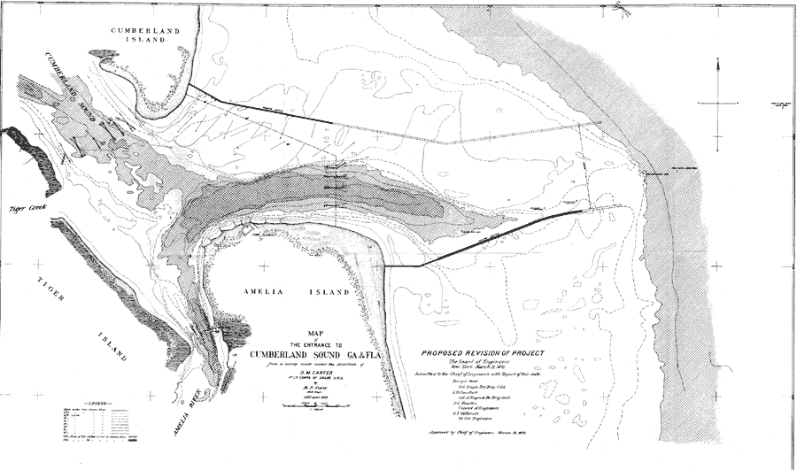
Description: A map of proposed revisions of the project to improve the entrance to the Cumberland Sound between Florida and Georgia. The original plan called for the construction of jetties to improve the waterway. This map shows the proposed extensions of these jetties. The map shows high water lines and soundings, marker buoys, survey station data, Reed's Mill, and Fort Clinch.
Source: O. M. Carter, Annual Report of the Secretary of War (Washington, DC: Government Printing Office, 1891)
Map Credit: Courtesy the private collection of Roy Winkelman
SearchLicensePDF HelpGIS Help Google Earth Help Zoomify Help

 FL Maps > Local > Nassau > Map of the Entrance to Cumberland Sound, 1891